



VOR ILS GPS

وصف لـVOR ILS GPS
This application is NOT CERTIFIED to be used FOR FLIGHT GUIDANCE.
Use only in Visual Meteorological Conditions.
Do not use as single source of guidance.
The developer is not responsible for damage resulting from incorrect usage of this application.
- You must define a reference point: VOR, ADF, NDB, or the touchdown point of a runway.
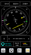
- The Horizontal Situation Indicator will provide indications to this point.
- The green arrow indicates the heading to the reference point.
- If the reference point is the touchdown point in a runway, the HSI will provide also indications to fly a 3º glideslope to that point (simulating an ILS approach).
- Choose the course you want to follow. The Course Deviation Indicator will diplay a deviation up to 10º each side of the selected course.
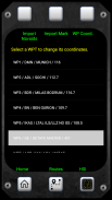
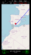
- The reference point must be defined introducing its coordinates and gps altitude. You can introduce up to 20 waypoints.
- You can save the coordinates of your current position by pressing the Mark button and importing them as a new waypoint.
Example:
N 40º 22' 12.92"
W 003º 46' 36.4"
Connect the location sensor of your device.
The information provided during the first two minutes (mainly the altitude data) will not be reliable.
Warning: Some devices do not provide gps data when in battery low mode.
لا يتم اعتماد هذا التطبيق لاستخدامها للحصول على إرشادات FLIGHT.
استخدام فقط في حالة الأرصاد الجوية البصرية.
لا تستخدم كمصدر وحيد للاسترشاد بها.
المطور ليست مسؤولة عن الأضرار الناجمة عن الاستخدام غير الصحيح من هذا التطبيق.
- يجب عليك أن تحدد نقطة مرجعية: VOR، ADF، NDB، أو نقطة هبوط من المدرج.
- المؤشر الوضع الأفقي ستوفر مؤشرات إلى هذه النقطة.
- السهم الأخضر يشير العنوان إلى نقطة مرجعية.
- إذا النقطة المرجعية هي نقطة هبوط في المدرج، فإن HSI توفر أيضا مؤشرات أن يطير glideslope 3º إلى تلك النقطة (محاكاة نهج ILS).
- اختيار بالطبع كنت تريد أن تتبع. فإن مؤشر الانحراف دورة diplay انحراف تصل إلى 10º كل جانب من الدورة المختارة.
- يجب تحديد النقطة المرجعية إدخال الإحداثيات والارتفاع لتحديد المواقع. يمكنك إدخال ما يصل الى 20 نقاط الطريق.
- يمكنك حفظ إحداثيات الموقع الحالي الخاص بك عن طريق الضغط على زر مارك واستيرادها باعتبارها نقطة الطريق الجديد.
مثال:
N 40º 22 '12.92 "
W 003º 46 '36.4 "
ربط أجهزة الاستشعار موقع جهازك.
فإن المعلومات المقدمة خلال أول دقيقتين (أساسا البيانات الارتفاع) لا يمكن الاعتماد عليها.
تحذير: بعض الأجهزة لا توفر بيانات نظام تحديد المواقع عندما تكون في وضع البطارية منخفضة.


